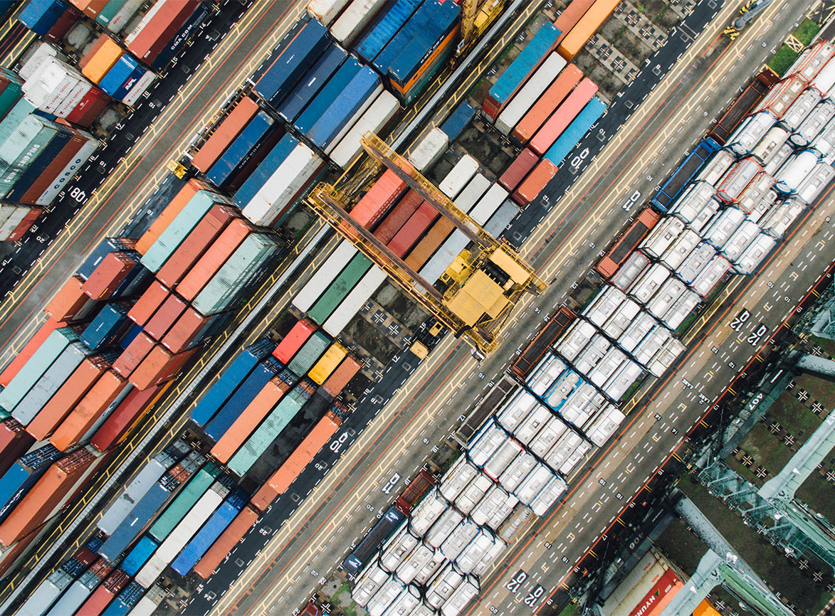
Blume Global is revolutionizing the game for shippers with Blume Maps, a dynamic, digital map of the supply chain world.
Planning, tracking, and adjusting supply chain shipments isn’t easy. There are countless factors to keep track of — from traffic congestion to poor weather conditions — so it can be a time-consuming and even overwhelming process. To simplify the planning and tracking of shipments, Blume Global, a leader in global logistics and digital supply chain visibility solutions, is releasing updates to its Blume Maps digital twin of the supply chain.
New updates to Blume Maps include:
- Interline Rail Schedules
- An LTL schedules UI
- Lead time reporting, reliability scoring and emissions for ocean sailings
What Is Blume Maps?
Blume Maps provides its users with a digital twin of the supply chain, helping them plan, track and adjust their shipments — regardless of where they are in the supply chain. Powered by patented data science technology, this dynamic map of the supply chain world is run natively on Google Cloud. Using Google Cloud’s services, Blume is able to collect, clean and provide users access to accurate logistics data directly from carriers.
While Google Maps helps families find locations and discover efficient routes for road trips, Blume Maps enables shippers to plan shipment routes, track progress in real time, receiving accurate ETAs for shipments sent via air, road, ocean and rail. Blume Maps can also provide users with alternative transportation modes, carriers or routes should they encounter any problems or delays. This increased supply chain agility allows shippers to change course mid-journey, helping them deliver packages to their customers as quickly and cost-effectively as possible every time.
Why Is Blume Maps So Revolutionary?
One of the biggest challenges shippers face is predicting a product's lead time and ETA. After all, several unpredictable factors that can influence a package’s ETA — from stormy weather and wet roads to port congestion and a lack of readily available equipment or capacity — are out of their control. That’s where Blume Maps comes in.
Blume Maps is a revolutionary tool for shippers due to the density of its international network. Blume's machine learning-enabled lead time and ETA engine is powered by a massive database that's several decades in the making. Blume has curated data from more than 1.5 million global locations, flights, ocean voyages, train journeys, first- and last-mile over-the-road moves. This extensive data collection enables Blume Maps to provide accurate lead time, dynamic ETA, and more accurate predictions of future events.
Blume Maps' work starts long before a shipment begins its journey. Shippers can use intelligent historical data, variable lead times, schedules, and cost implications to plot the most efficient routes and estimate transit times. Once they’ve shipped a domestic or international shipment, shippers can then track their order, whether it’s traveling by rail, road, ocean, or air. They can also view where it is and when they can expect it to arrive in real-time, which allows them to stay on top of shipments. Blume Maps will also enable them to improve their customer service without hiring additional staff, as their customers can view an order’s status or track “HOT” shipments at any given time.
Blume Maps is particularly revolutionary when it comes to generating ETAs for domestic truckload and LTL shipments. Many small trucking companies use technology that is completely isolated from shipper-driven TMS systems, which has historically made creating accurate ETA calculations for domestic FTL and LTL shipments a challenge. Blume Global’s R&D team has spent years extensively testing the technology behind Blume Map’s lead time and ETA calculations to ensure they more accurately account for domestic FTL and LTL shipments. The R&D team uses reinforcement learning techniques and probabilistic graphical models to shrink the issue of domestic FTL and LTL ETA calculations and reduce it to its component parts, enabling a technology that can react to user-driven actions as well as bring increased visibility to all stakeholders.
From report analytics to continuously updated ETAs, Blume Maps provides shippers with an unparalleled level of supply chain visibility. Blume Maps can help shippers better understand the risk of committing to specific delivery dates and will even alert them of any early or late shipments. If a shipment is delayed due to traffic, customs delays, or inclement weather, Blume Maps lets shippers pivot to meet their promised delivery dates as cost-effectively as possible. For example, Blume Maps might recommend alternative transportation modes, carriers, service levels, and routes. It will also alert shippers of any potential opportunities and exceptions based on their business priorities. This will allow shippers to address any exceptions in real-time and maximize their time and energy by prioritizing the opportunities and issues that have the most significant impact on their business.
Blume Global is committed to sustainability, which is why we’re the first carbon-neutral logistics provider. It’s also part of why we created Blume Maps and other innovative technologies that digitize the supply chain to capture real-time data and connect stakeholders. To know more about the solution, Connect with us here - https://bit.ly/34x9WMH
All news
Latest news
contact us
Contact Us